January 19, 2016
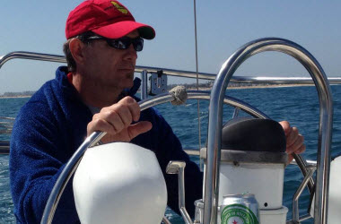
Since the early 2000s, there has been an international effort to monitor the temperature and salinity of the world’s oceans. The Argo project (http://www.argo.ucsd.edu/), with more than 3600 buoys around the world, collects data at various depths and sends this data out every 10 days. In addition to salinity and temperature, there are select buoys that also record pH. While all this data is great for scientists, it can be difficult to get it in the hands of students. Ocean First Education has solved this problem by making a free Data Portal to access the Argo data (http://oceanfirsteducation.com/research/live-ocean-data.)
In the Data Portal, students can explore data graphically, either on a map or an interactive pivot chart. The map provides a great way for students to explore the world’s oceans and investigate the differences between the various seas and oceans. Students can click on a buoy and compare the data to a buoy in a different region. Not only is current data available, but historic data can also be explored. Even though it is summer right now, a student can look back to last fall or winter to see how the oceans change with the seasons.
The pivot chart is a very powerful tool students can use to explore the data further. By selecting variables such as bodies of water, latitudes and longitudes, and even Exclusive Economic Zones, students can explore data from oceanic regions around the world. The pivot table also presents an opportunity for students to explore the relationship between dependent and independent variables. While a student can compare depth and latitude, this would probably not be a useful display. Instead, a student could look at how temperature varies with depth. To interact with the pivot chart, a student simply drags and drops the different variables to either the x- or y-axis. Each variable also has a drop down menu with available options. For example, a student can take the Bodies of Water option and select only the Black Sea data.
There is a growing need in the scientific community for an easy-to-use public data portal. Most grants have an outreach requirement where scientists need to make their data open to the public and present it in an understandable manner. To help with this requirement, the Data Portal will be updated to allow public display of various datasets. The goal is to be a portal for research scientists to be able to upload their data and know that it will be reaching a wide audience.
Check out the Ocean First Education's Data Portal, User's Guide, and a Lesson Plan at https://oceanfirsteducation.com/research/live-ocean-data.